Typhoon "Taili" landed in China for the second time or greeted 3 to 5 typhoons.
△ On July 18th, News Network reported that Typhoon Taili landed in China twice.
Cctv news: What are the key issues of today’s News Network? What hot events have been tracked? CCTV will sort out the hot spots in News Network for you.
Typhoon is a strong cyclonic vortex that occurs on the tropical or subtropical ocean surface. When a typhoon comes, it is often accompanied by violent storms, which may bring serious disasters to the affected areas.
At about 10: 20 pm on July 17th, the No.4 typhoon "Taili" landed on the coast of Zhanjiang City, Guangdong Province in 2023, becoming the first typhoon to land in China this year. Then, around 5: 45 am on July 18th, Typhoon Taili made a "second" landing in Beihai, Guangxi.
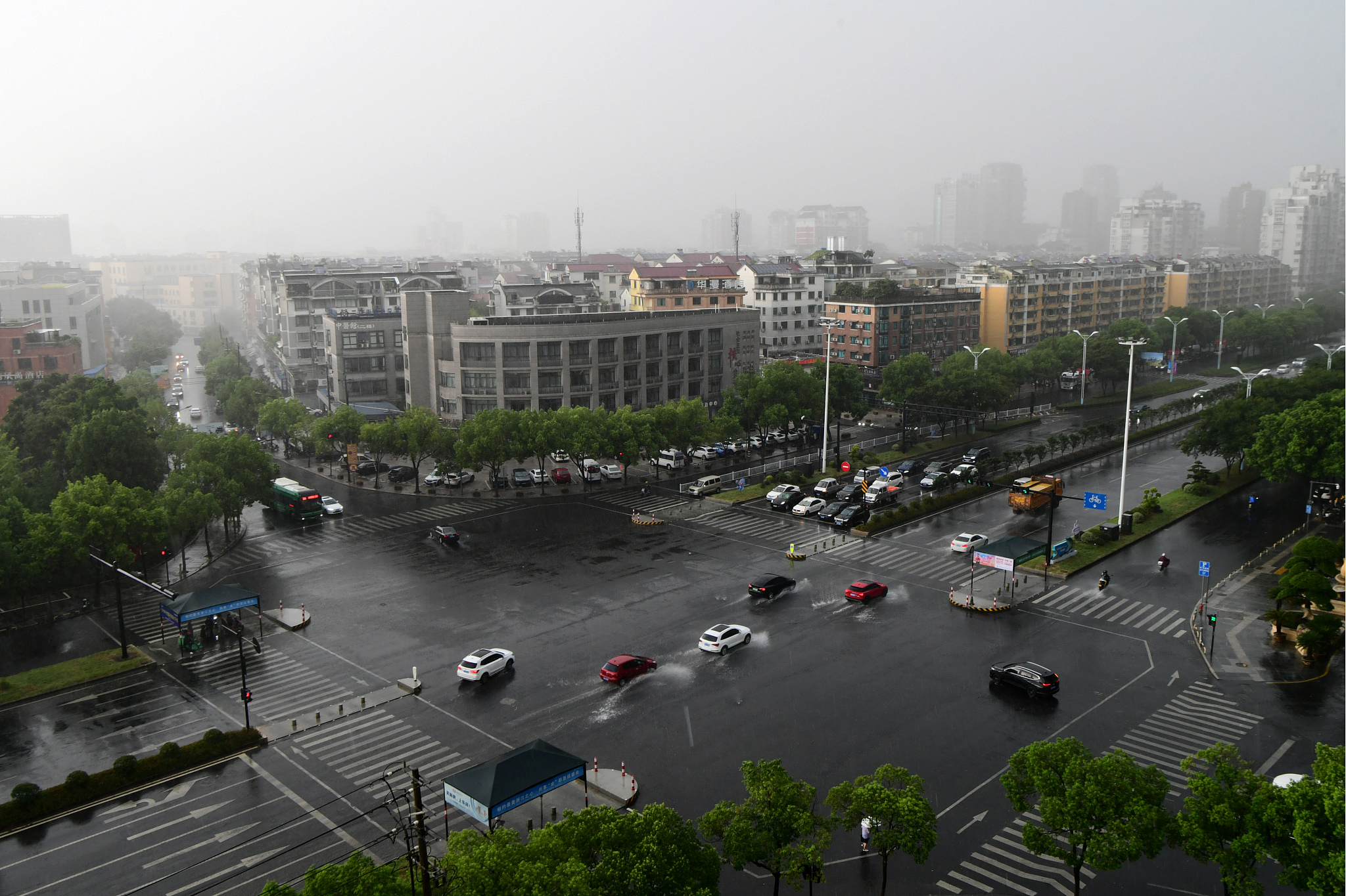
△ On July 18, 2023, affected by typhoon "Taili", Jinhua, Zhejiang Province ushered in heavy rain and the car was driving in the rain.
Typhoon transits, and Hainan, Guangdong and Guangxi take refuge.
Influenced by Typhoon Taili, on the evening of July 17th, the Ministry of Water Resources and China Meteorological Bureau jointly issued the first meteorological warning of red mountain torrents this year.
When Typhoon Taili struck, Haikou implemented the "six stops" measures of "suspension of classes, suspension of work, suspension of service, suspension of navigation, suspension of parks and closure of business"; The Hong Kong Stock Exchange suspended trading and several flights were cancelled; Many trains in Nanning, Fangchenggang and other places were temporarily suspended, and about 1.27 million residents in Guangxi were temporarily cut off … …
At 18: 00 on July 18, the typhoon warning issued by the Central Meteorological Observatory showed that Typhoon Taili had weakened to a tropical storm level at 12 noon that day, and it was expected to move from Guangxi to northern Vietnam on the night of the 18th, and gradually weakened and dissipated.
With the gradual dissipation of Typhoon Taili, many cities in Hainan, Guangdong and Guangxi in China have gradually returned to normal production and living order — — Trains resumed operation one after another, buses and taxis resumed operation in an orderly manner, shopping malls and farmers’ markets resumed business, and enterprises, institutions and factories resumed normal work in an orderly manner.
△ On July 17th, "News Network" reported continuously that Typhoon "Taili" is expected to land in many places tonight and actively respond.
The climate is abnormal, and China may face 3 to 5 typhoons.
At the beginning of July this year, the World Meteorological Organization announced that El Niñ o conditions were formed in the tropical Pacific for the first time in seven years.
In recent years, the world is getting warmer, and this year El Nino phenomenon "buff" is superimposed (Game term, meaning effect.), which may lead to more frequency, wider range and stronger intensity of extreme weather around the world.
Just this summer, many provinces in northern China suffered from high temperature, and the daily maximum temperature of meteorological stations in Beijing, Tianjin and Hebei, Shandong and other places exceeded historical extremes; At the same time, many provinces in the south suffered from large-scale continuous heavy rainfall.
Will this year’s typhoon activities get the superposition "buff" of El Niñ o phenomenon?
In early July, at the press conference of China Meteorological Bureau in July 2023, Jia Xiaolong, deputy director of the National Climate Center, analyzed that in the first half of 2023, there were three tropical cyclones in the northwest Pacific Ocean and the South China Sea, and the number was not large, which was not directly related to El Niñ o.
Jia Xiaolong believes that tropical cyclone activity is expected to usher in an active period in late July. The number of tropical cyclones in the northwest Pacific and South China Sea is 6 to 9, which is 9.4 in the same period of the year. Among them, 3 to 5 may land in China, which is 4.2 in the same period of the year.
Safety tips, it is best not to go out and stay at home.
When the typhoon comes, it is best not to go out and stay at home quietly. Pay attention to the following points:
● Turn off electrical equipment and cut off unnecessary power supply in time.
● Check whether the facilities such as fire and gas are safe.
● It is necessary to put away all kinds of hanging items, reinforce air-conditioning plug-ins, and move balconies, flower pots outside windows, etc. indoors.
● To tie the doors and windows tightly and securely, you can paste the "meter" pattern on the window glass with adhesive tape to prevent the window glass from being broken.
● It is best to prepare emergency items such as mobile power supply, flashlight and candle, store drinking water and food, and don’t go out unless necessary.
If you are outdoors, please don’t stay under dangerous sheds, temporary buildings, billboards, neon lights and other high-altitude buildings; At the same time, avoid walking on embankments and bridges near rivers, lakes and seas, so as not to be blown down or blown into the water by the wind.
After the typhoon crosses the border, it does not mean that the danger is completely lifted.
Before you go out, you should know the road section. In addition, the garbage at home should be cleaned up in time. If there are flooded houses and public places, please do disinfection and sanitation in time.
Pay attention to news hotspots, and see you in News Network!
(Reporter Yang Wenxuan, Qian Jingtong)